September 17, 2018
 Public Outreach Meetings on New FEMA Flood Maps: Presented by City of Alameda Public Works Department
Meeting #1:
When: Wednesday, October 3, 2018 at 7:00 pm
Where: Community of Harbor Bay Isle Owners’ Association, 3195 Mecartney Rd, Poppy Room, First Floor
Meeting #2:
When: Wednesday, November 15, 2018 at 7:00 pm
Where: City Hall, 2263 Santa Clara Ave, Alameda, CA 94501 – Council Chambers, 3rd Floor
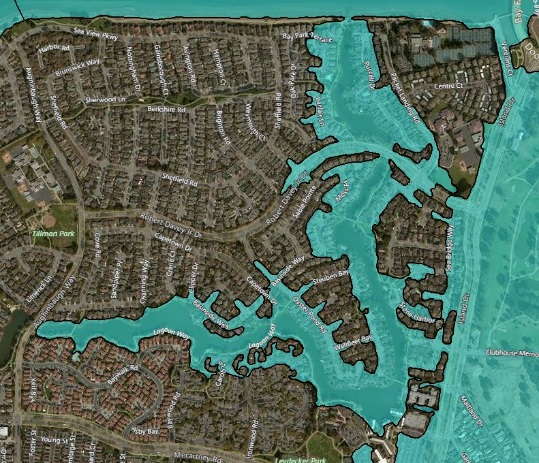
The Federal Emergency Management Agency (FEMA) has recently revised the Flood Insurance Rate Maps (FIRMs) within Alameda County which may affect the floodplain designation of your property in Alameda. The new maps become effective on December 21, 2018 and have added approximately 2,000 City of Alameda parcels within the Special Flood Hazard Area, commonly known as the 100-year floodplain.
City Staff will present the newly revised FEMA flood maps which become effective December 21, 2018. Parcels mapped in the new flood zone are required to purchase flood insurance if they have a mortgage.